Tag Archives: Lake District

Patterdale to Shap

June 25 – Today we enjoyed a leisurely breakfast, then walked down to the pier to catch the morning Ullswater steamer.

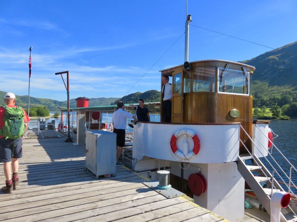
As always, dogs are welcome on board!

The ferry took us about six miles, on a clear, gorgeous morning.
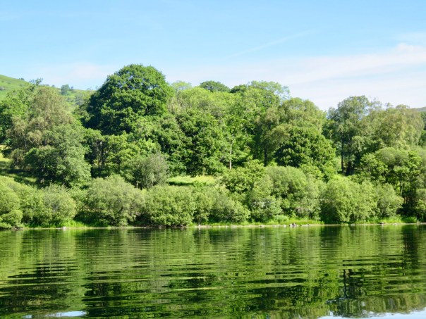
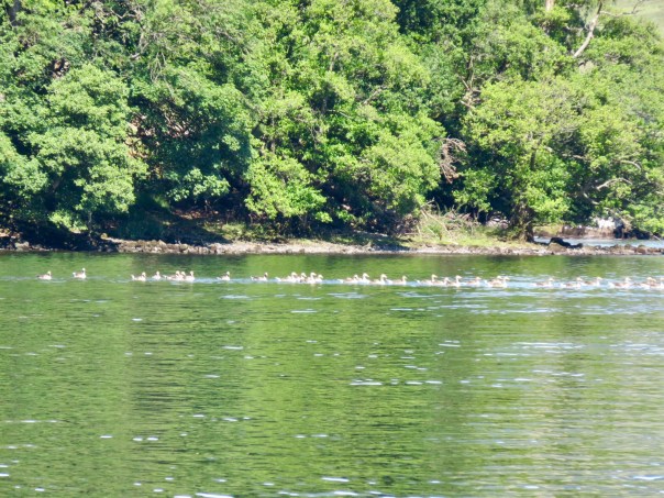
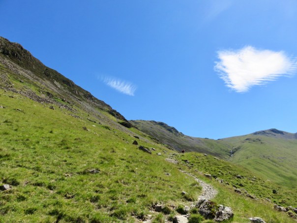
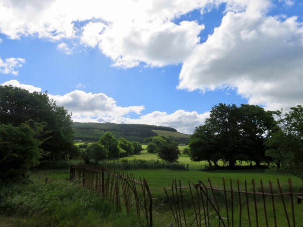
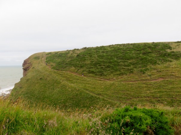
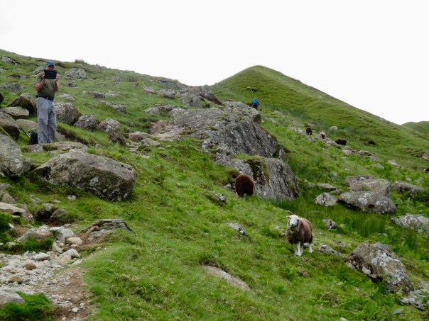
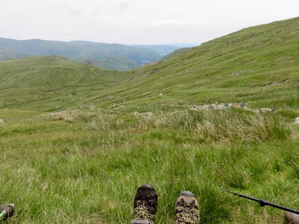
We got off at a dock called Howtown. If there was a town there, we didn’t see it. From the dock, we had a steep hike up along the Ullswater.

We planned an eleven mile walk to get us to the town of Shap. Yesterday, I considered not doing this walk at all, as I was pretty exhausted from all the mountain climbing. It turns out the bus to Shap only runs once a week, and today was not the day. So up we walked!

This gives a different meaning to “walking the dog”. The owner said this old gal recently had a stroke, and they couldn’t bear to leave her at home when they were going out walking.

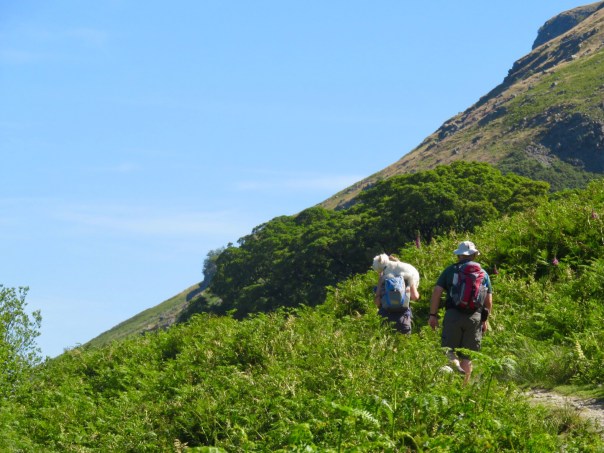
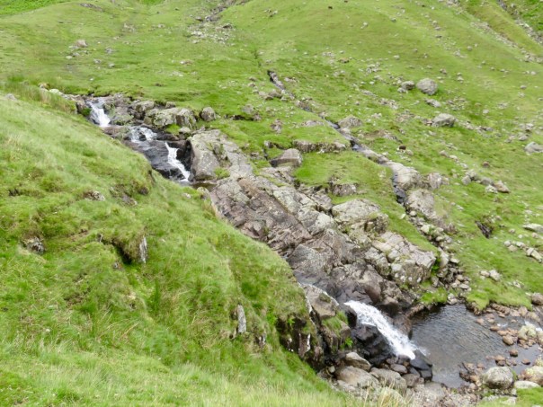
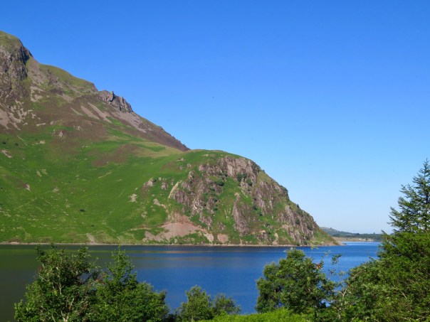
Here is Wainwright’s Stone, where the founder of the Coast to Coast Walk liked to sit and gaze out on the Ullswater. It is inscribed with his words, “that loveliest of lakes, curving gracefully into the far distance”.

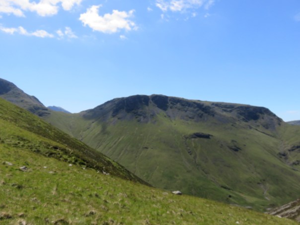
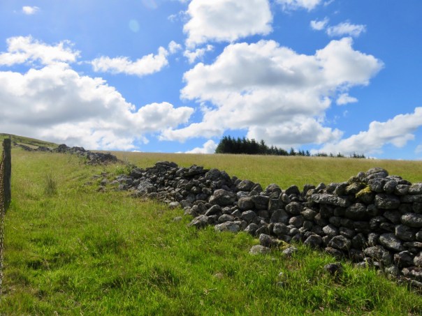
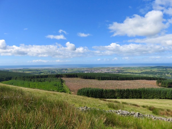
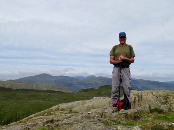
After a couple of hours, we reached the top of the Arkham Fell, and the land flattened out. Here is an ancient stone circle, called The Cockpit.

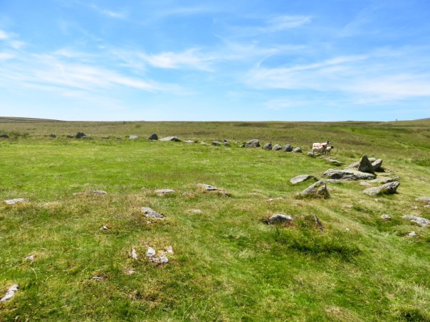
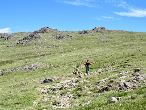
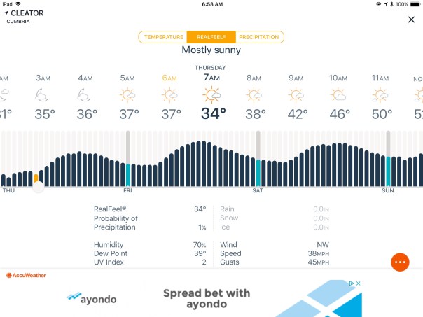
Today was the hottest day of the year so far, (it got up to 77 degrees!) so we brought along our hiking umbrellas, which gave us our own little bit of shade. This terrain reminded us of walking in Spain.

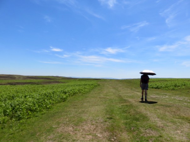
Before we knew it, we were getting close to Shap. The postman stopped and offered us a drink of water and a tract about Jesus. We talked to a man who was a dry wall builder, which means that he builds the stone walls back up after a car or a cow knocks one down. All the walls around here are “dry”, meaning no mortar is used. He got to knock off work early today on account of the heat!

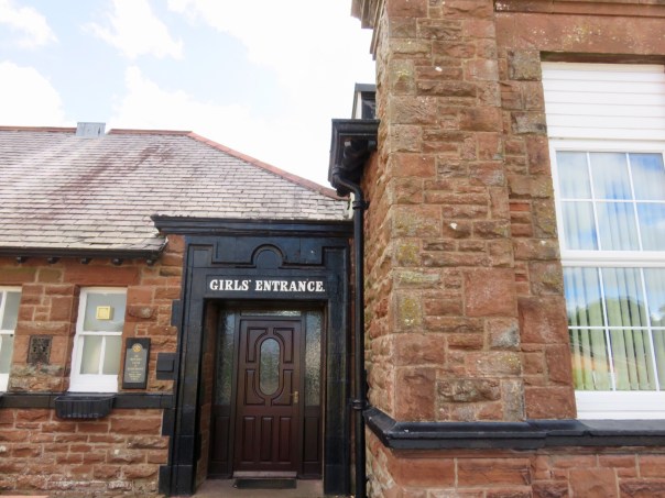
The town of Shap was a one road town that looked pretty deserted. We got to our hotel, The Greyhound, which looked closed. Turns out, the hotel, which has been around since 1680, had been closed for renovations for a year, and just reopened. We tried all the doors and eventually got in through a service door and shouted to no avail for attention. None of the rooms are labeled yet, there is construction dust and materials all over, and we kept getting lost. We finally found a door that led to the bar, where one person was waiting for us. After she checked us in, she left! Worst of all, the WiFi doesn’t work. Oh, holiday horror!

Coast to Coast – Grasmere to Patterdale

June 24 – Okay, I’m getting bored with these mountain climbing adventures, and I bet you are too. I can’t help it – every day there’s another mountain!

Grasmere was the birthplace of the poet William Wordsworth, and his childhood home is a museum here. Many of his poems were created as he ambled among the very same mountains that we are walking. I wandered lonely as a cloud, that floats on high o’er vales and hills, when all at once I saw a crowd, a host of golden daffodils.

Wouldn’t you like to live right here by the quiet mountainside?

Today was more of the same, only a bit easier, as the walk had some switchbacks and we got to contour along the side of the hill instead of climbing straight up along the steep sheep paths. Or maybe I’m getting stronger?

We met a couple from California, Becky and Jerry, who were actually walking as slowly as we were. We took turns passing each other all day.

Today was the warmest day so far, and sunny. Hey, what is that? A crop circle?

At the top of today’s crag, we found a tarn! I didn’t realize I’d have to learn another language to do this walk. A tarn is a small mountaintop lake. See the campers at the shore? I wonder how they got there.

Not pictured are some others who passed us on the trail: two mountain bikers who skidded and fell down the stony paths, two joggers who literally bounced down over the rocks, a couple from Spain and another couple from Belgium, who had both done some of the same Caminos that we did.

Walking into Patterdale, we spotted this sign. Somebody please tell Pat she could be monetizing her weekly practice time!

Now the good news. This is the last mountain climbing post, for a while at least. Tomorrow, I promise something different!

Seatoller to Grasmere

June 23 – We had a lovely dinner last night with a room full of retired Brits on holiday, who wanted to know our thoughts about American politics and education. The only topic they all agreed on was that they were against vegetarianism. Lucky for me, I could speak knowledgeably about the current seasons of The Crown and Call the Midwife, so conversation never flagged.

Yesterday was only the second in a series of horrendous mountain adventures. I apologize in advance if I resort to more whining today.

We picked up our path at Stonethwaite, where many people were camping. Today is Saturday, so the trail will be busy.

Up we go!

Drat! Those big rocks again!

Gaining altitude. Don’t these sheep have the sweetest faces?

Lots of waterfalls today.

Getting higher!

The first summit!

I thought we were done, but there were two more summits to climb. One of them was called Lining Crag. Don’t ask me which one.

My lunchtime view. Note that one of my boots got stuck in the muddy bog.

On our way down, we met about 50 girls climbing up with full packs. They were all on a four day expedition to qualify for their “D of E”, the Duke of Edinburgh Award for all around achievement in creativity, community volunteering, physical skills and leadership. Very impressive!

Baa baa colorful sheep, have you any wool? Silver, black, brown or white, what color sweater would you like?

When we finally reached the road toward Grasmere, a mum with two toddlers immediately pulled over and asked if we needed a lift into town. Yes! I must have looked as sorry as I felt. I climbed in the back between 6 year old Robert and 4 year old Stephen in their car seats, and we had a lovely chat. Nice People of England!

Coast to Coast – Ennerdale Bridge to Seatoller

June 22 – Approached today with a little trepidation. We are looking at a 14 mile day with a whopping big climb in the middle, to Grey Knott, part of the Haystacks range, I think. There are lots of mountains, crags, fells and hills in this area of the Lake District National Park, so it’s hard to know which one you’re climbing. Luckily we have another sunny day.

Because our B&B is on the north side of town, we walked on the north shore of the Ennerdale Water, and got to see Bowness Knot, where the locals say that a young Bill Clinton proposed to a young Hillary many years ago. A pretty place.

After walking the shoreline for several pleasant miles, the Water became the Liza River, and we started to gain some elevation. 
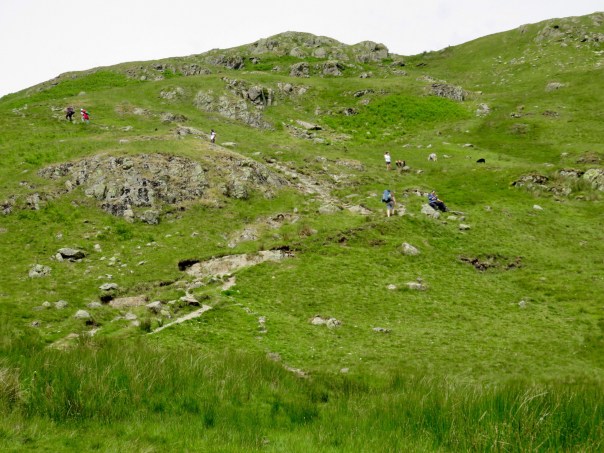
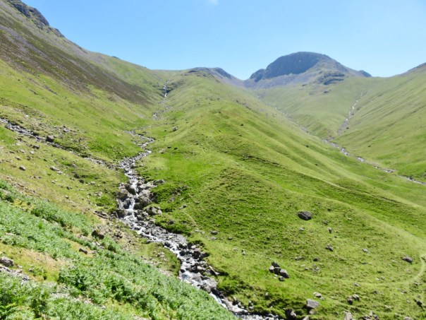
We’re using two different guidebooks for this hike, and they both cautioned that today was a climb where many people get lost. We looked for the Black Sail Youth Hostel, which was far beyond the middle of nowhere, then searched for an almost invisible path that followed a stream bed. There are NO markers to guide us. We got it right on the second try!

Now, remember how yesterday’s climb was an easy up and a difficult descent? Today was an absolutely impossible climb, that took us so high that I got nauseated looking down. So steep! Pictures just do not convey, nor can I adequately describe, how high up we were. This was the path up with no discernible trail – scrabbling up rocks and more rocks!

Once we got to the notch, I was able to look forward without getting dizzy. The most horrific climb of my life. It felt like we were on the moon. When we got to the top, there was no breathtaking vista to see, only more mountains all around.

The descent was gentle by comparison, but was comprised of uneven rocks all the way. Still no trail, but our instructions said to walk from cairn to cairn. No fun for my poor ankle, which was screaming for relief by this point. Hello, Uber?

Here’s the Ennerdale Water that we walked along this morning, way down below.

More uneven rocks, all the way down.

Happy to say that we eventually made our way back to terra firma, and I’m now snuggled in at Seatoller House, with my ankle elevated and ibuprofen close by.

Tonight we have a set communal dinner with the other residents of this B&B. Should be fun!

Cleator to Ennerdale Bridge

June 21 – Happy first day of summer to you! Our morning weather check let us know we would have sunshine for our walk today, but it was currently 34 degrees F!

Our objective today is to climb Dent Fell, which has the steepest descent of the entire walk. Sounds like fun!

We left Cleator (pronounced Cleeta) after sharing a full English breakfast. Really, one meal is more than enough for the two of us! The hotel used to be a girls boarding school, as you can see by the door:

The morning is bright and sunny. Dent Fell looks like a gentle little hill in the distance. A fell is another name for hill or high moorland.

Isn’t there a Bible verse about the cows lying down with the sheep? Maybe not.

The path up the fell was a gentle climb through dark piney woods:

Then a steeper climb following a rock wall:

Some backward views of the land below:

And then we reached the cairn on top – easy peasy, cool and breezy!

We started to descend, congratulating ourselves on a job well done.

Then we reached the tallest stile so far, and the descent got interesting.

The descent was so steep, I had to turn sideways, mince down using baby steps, and depend on my walking sticks for balance. No pix here – too scared!

After a really long time, we reached the bottom and the path leveled off. Dent Fell didn’t look so gentle from this side!

Tonight’s B&B is a farm two miles out of town, so we were advised to get a meal while we were in Ennerdale. Fish and chips and a pint really hit the spot after our walk. The beer here is named Wainwright’s, after the founder of the Coast to Coast Walk. Find your mountain!

Coast to Coast – St. Bees to Cleator

June 20 – We arrived to breakfast at 7:30, thinking we’d be the first ones up, to find the dining room packed with hikers eager to get an early start on their first day of the Coast to Coast Walk (C2C) 192 miles from the Irish Sea eastward to the North Sea.

Our first view of the Irish Sea.

Here is the map posted at the start of the walk.

The morning is cold and windy and overcast. It may be raining, or we may just be getting hit with sea spray carried by the wind, but it is definitely wet. Our first task is to climb up the cliffs overlooking the Irish Sea. It is a hard, steep climb. The wind is so strong I have to occasionally stop and crouch down, for fear of being blown out to sea!

Please note that the fence is erected for the protection of the sheep. The walkers are outside the protection. This ain’t Disneyland!

Our next objective is to reach the lighthouse at St. Bees Head. Can you see it in the distance?

I thought once we were up on the cliffs that the walk would become easier, but the first cliff ended, we had to walk all the way down, then up the next one.

This is as close as we got to the lighthouse.

After a while the sky began to clear and we could see the sun peeping out!

We walked through a red sandstone quarry. Don’t these stones look like a sofa?

We left the cliffs and walked inland into town of Sandwith (pronounced Sannuch). This was at the first house we came to!

We continue to be impressed with everyone’s courtesy toward dogs. In every town, water dishes are set out. Dogs are welcome on trains and in pubs.

Now that the sun is out and ground is mostly level, it’s a lovely walking day. Temps in the 50s. Pretty scenery.

Interesting sculptures.

Hey! Who are those good looking folks?

Ten miles down, 182 to go!

Windermere to St. Bees

June 19 – Yesterday, we walked to the train station to purchase our tickets for the two hour ride to St. Bees, where our next hike will begin. We’ve been hearing about the transportation issues here, and now we are going to experience them firsthand. The railroad workers are on strike. No trains today.

The ticket seller asked if we were aware that there would be no trains on Tuesday. We said we were, and we understood that there would be buses provided instead. Trying to dissuade us, he said it would take four changes of bus and four hours to get us to St. Bees. I asked if he had any other suggestions. “I suggest you don’t go,” was his reply. But he sold us the tickets. Here’s some wall art at the station.

When we got to the station this morning to catch our first bus, we were told by a passenger that there was a train running for the first leg of our journey, so we hopped on for a 30 minute ride.

Ditto the second leg, which took us to Carlisle up north near the Scottish border.

Here’s Carlisle Castle:

The third leg was a two hour bus ride back south to Whitehaven, and the fourth was supposed to be a twenty minute bus ride to our final destination.

But… yes, you guessed it: 22 people got off the Whitehaven bus, and only 14 could be accommodated on the local bus. Aaarrrgghhh! The ticket lady at the station separated us by destination, and said she would call taxis for the eight of us going to St. Bees. What she didn’t tell us was that the railroad would not be paying for these taxis.

Well, now we are at St. Bees, named for Saint Bega, a probably mythical Irish princess who washed up here in a little boat rather than marry the Viking her dad picked out for her.

Here is a statue of her seeing the Virgin.

St. Bees Priory housed monks for many years, and is still an active parish. I liked that some of the stained glass windows portrayed Old Testament scenes. Here is Abraham and Isaac:

Joseph and his brothers:

The church also contains a portrait of Alfred Wainwright, who first documented the Coast to Coast Walk from the Irish Sea to the North Sea. His book from 1973 is still the guide to use.

We are staying in a really posh B&B suite that used to be a milking barn. Here is the picture of the barn hanging in our room:

I really like how old buildings are upgraded and repurposed here, rather than being torn down the way they would be in the US.

Tomorrow we start the Coast to Coast Walk!